What Cold Water In The North Atlantic Means For Hurricane Season
This hurricane season in the North Atlantic, as El Niño digs in and prepares to cool burlier tropical depressions onto their heels, a strange but historically cyclical cooling event in the waters south of Greenland suggests a weakening Atlantic Meridional Overturning Circulation (AMOC) might leave temperatures to the south might, as suggested during the last great cold blob of 2016, further diminish hurricane development.
A lighter-duty hurricane season, of course, means a collective sigh of relief among coastal and coastal-adjacent communities at large, and a whiffling sniffle from the few who look forward to the chance to ride on the back of something taller than the toddler-sized trade-wind swells that stave off abject starvation for East Coast surfers during most of the warmer months.
The ocean currents giveth, and the ocean currents taketh away.
Then again, more recent research conducted in 2021 by the Intergovernmental Panel on Climate Change (IPCC) suggests a shift of rainfall patterns across the tropical Atlantic as well as a realignment of storm tracks across the North Atlantic.
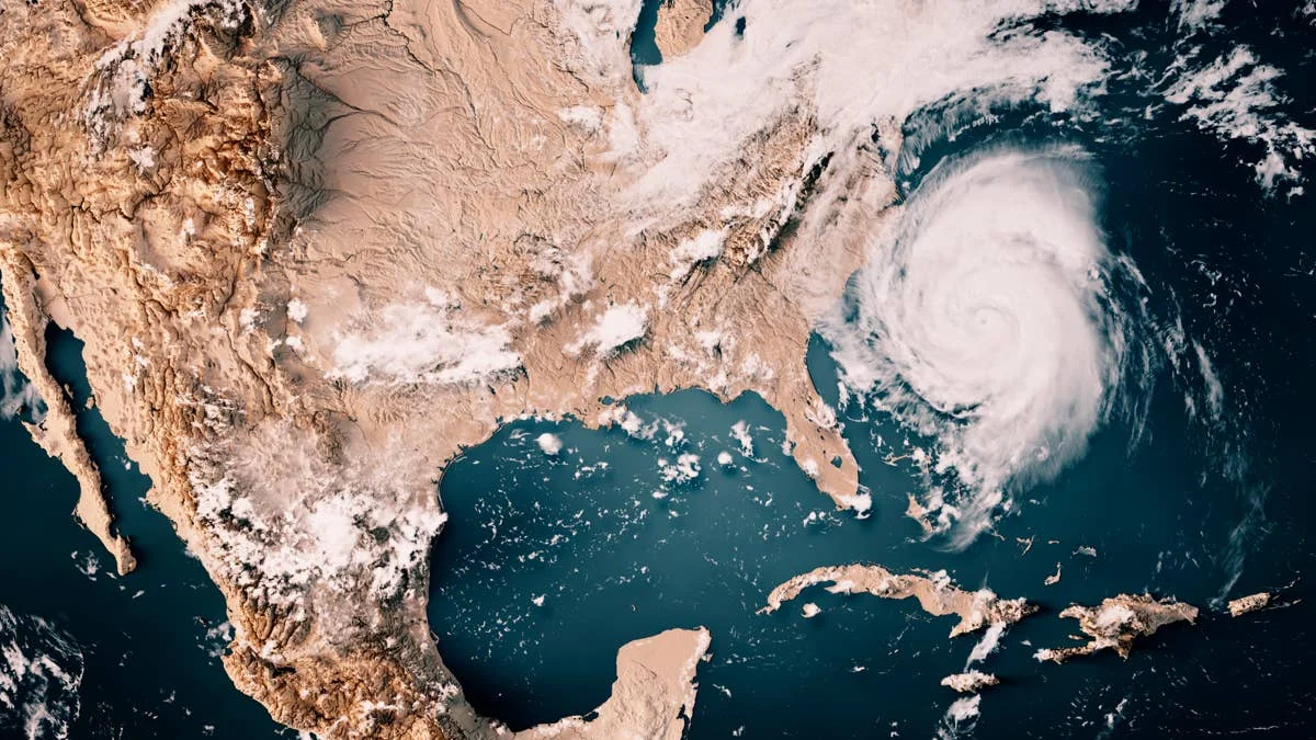
Category 5 Major Hurricane Erin alongside the east coast heading to the north.
NOAA
To where, and to what degree? The IPCC’s report points to greater effects being likely in the waters off the Atlantic seaboard of the U.S., but in the end, their hands are in the air with the rest of us.
The last time the cold blob was making headlines, in 2016, forecasters suggested that cold water carried south from the blob might lead to both an “earlier-than-expected” and busier-than-average hurricane season. And in fact it was, with 15 named storms (12 being average) and four of which precipitating into major hurricanes (Category 3 and up).
“I don’t think that this is necessarily alarming. There was a similar freshening of the far North Atlantic in the late 1960s and early 1970s,” Phil Klotzbach of the Colorado State University Tropical Meteorology Project told Charleston, South Carolina’s Post and Courier. “I think there’s a lot of question[s] as to what is the primary driving factor of the cold blob.”
Related: It's Official: NOAA Declares ‘Very Strong’ El Niño Is Happening
The “cold blob” phenomenon has largely been attributed to melting sea ice to the north, of which there’s no shortage at this moment. And overall, according to heat-flux data going as far back as 1870 (the earliest days of weather records), the amount of heat escaping from North Atlantic waters has decreased by almost 1.8 degrees Fahrenheit (one degree Celsius) since 1900.
Things appear to be shifting, in one way or another, according to a most recent but largely inconclusive report published in the journal Geophysical Research Letters. Their big conclusion: Heat loss on the sea surface (the top 1,000 meters/3,280 feet) is best explained by “ocean heat transport” not capricious fluxes in sea-surface temperatures.
Cooler temperatures might, at face value, sound like fewer tropical depressions—coupled with the wider assessment that we’re in the middle of a fairly strong, tropical-storm damping El Niño (per NOAA)—but it’s more complex than that when you factor in shifting or “dying” currents.
Whatever doom and gloom that may portend (see: ScienceNews’ “The North Atlantic’s ‘cold blob’ may signal a major current’s decline, or “A strange ‘cold blob’ in the Atlantic could be a sign of trouble, per The Week), what do our hurricane forecasters have to say of what’s to come for the 2026 season? The hurricane season of a thousand? A conveyor belt of slow-rolling tropical depressions keeping their distance but lapping shores with agreeable long(er)-period swells on steady tap? Feast, famine, or something in between. NOAA is, after all, calling for a light one, but it seems like this season, more than any, surfers will wait with bated breath while only the gods can say. Time, alas, will tell.
Related: El Niño vs La Niña: How Pacific Mood Swings Reshape Surf Seasons